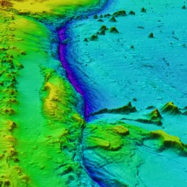
Revealing the Seabed Floor
-
English
-
ListenPause
[intro music] Welcome to World Ocean Radio… I’m Peter Neill, Director of the World Ocean Observatory. Where am I? A fundamental question – personally existential, institutionally relevant to measure, define, and assert a position in time and space. We have tools to help: the compass, the map, the geo-location device, translating the unknown to the known and indicating a way forward. At first, it was the wilderness, terrestrial density that needed exploration and conquest by which to build our cities, our factories, our economies, our nation-states. Technology helped, invention as wayfinding tools to survey new ground, set courses, draw boundaries, establish limits to protect territorial claims, lines not to cross without passport or permission, lines to cross in case of conflict or territorial aspiration. And then it was space – a new dimension that by scale alone demanded even more extensive, sophisticated technology – more physics, astronomical calculation, exploratory vehicles, satellite observations, software, amplifying our capacity to measure the earth below and space beyond to a decimal of almost infinite precision. What was left? Oh yes, the ocean – that, while representing only 0.05 percent of the Earth's total mass, nonetheless covers 70% of its planetary surface in layers of fluid mystery, a place of danger and darkness. Yes, charted and mapped but to always surprising inadequacy and incompletion. “We know more about the surface of Mars than we do the ocean,” is the oft-quoted statement of condition. In the fall of 2019, a partnership was announced between The Nippon Foundation, a Japanese philanthropy with demonstrated ocean interest, and the International Hydrographic Organization to undertake SEABED 2030, a collaborative project that aims to bring together all available data to produce A General Bathymetric Chart of the Ocean by that year, complete and open to the public. The project is seen as a major contribution to the United Nations Sustainable Development Goal 14: “to conserve and sustainably use the oceans, seas, and marine resources for sustainable development.” The purpose is to understand the relationship between the ocean floor and circulation, climate and weather patterns, tides, wave action and energy conversion, sediment transport, tsunami wave propagation, underwater geo-hazards, and other physical phenomena and obstacles to the utility of the world ocean, to include, one presumes, everything from fisheries to underwater cables, from deep sea mining to offshore oil/gas exploration, from data collection to applied technology and invention, all of which to be consolidated into a central repository (ironically located in Boulder, Colorado), and made available to all interests. The data will be collected by multi-beam echosounder equipment housed aboard such platforms as public and private research vessels, commercial ships in transit, fishing boats, and autonomous underwater ROVers, specifically to investigate the 93% of the ocean floor below 200 meters (the shallower inshore territorial waters to be charted by national agencies), through the participation of some 40 international organizations and networks across more than 50 countries. The project is complicated, ambitious, and expensive. The cost is estimated at some US$3 billion. To put that into perspective, the cumulative cost, adjusted for inflation, just for the US National Atmospheric and Space Agency (NASA) its space program is estimate at US$1.17 trillion, an average of US$19 billion per year over its entire history. How much of the value inherent in the knowledge deriving from space exploration has actually benefited the world economy? The sponsors of SEABED 2030 assert that this mapping project is vital “to the security, safety, and economic health of a ‘blue economy’ estimated at US$1.5 trillion per year and some 31 million fulltime jobs worldwide. It seems inexpensive at the price. So, where are we? The Nippon Foundation envisions a path forward, with clarity of purpose and action, with new technical tools and institutional cooperation, and with generous stimulus funding to unfold the ocean’s layers of fluid mystery, to enlighten a last place of danger and darkness, of wilderness now measured, unlimited, and known. What’s left? Well, the human psyche awaits . We will discuss these issues, and more, in future editions of World Ocean Radio. [outro music]
In 2019 a partnership was announced between The Nippon Foundation and the International Hydrographic Organization to undertake the GEBCO Seabed 2030 Project that aims to bring together all available data to produce A General Bathymetric Chart of the Ocean by 2030. This week on World Ocean Radio we outline the purposes of the project, seen as a major contribution to the United Nations Sustainable Development Goal (SDG 14): to conserve and sustainably use the oceans, seas, and marine resources for sustainable development.
About World Ocean Radio
Peter Neill, Director of the World Ocean Observatory and host of World Ocean Radio, provides coverage of a broad spectrum of ocean issues from science and education to advocacy and exemplary projects. World Ocean Radio, a project of the World Ocean Observatory, is a weekly series of five-minute audio essays available for syndicated use at no cost by college and community radio stations worldwide.
Resources from this episode
Nippon Foundation-GEBCO Seabed 2030 Project
Image credit
GEBCO
- Login to post comments


